40 Acres Bordering Wayne National Forest — District Four Whitetail Ground, 1,200-ft Ridges, Ridgetop Cabin Sites, Monroe County Ohio
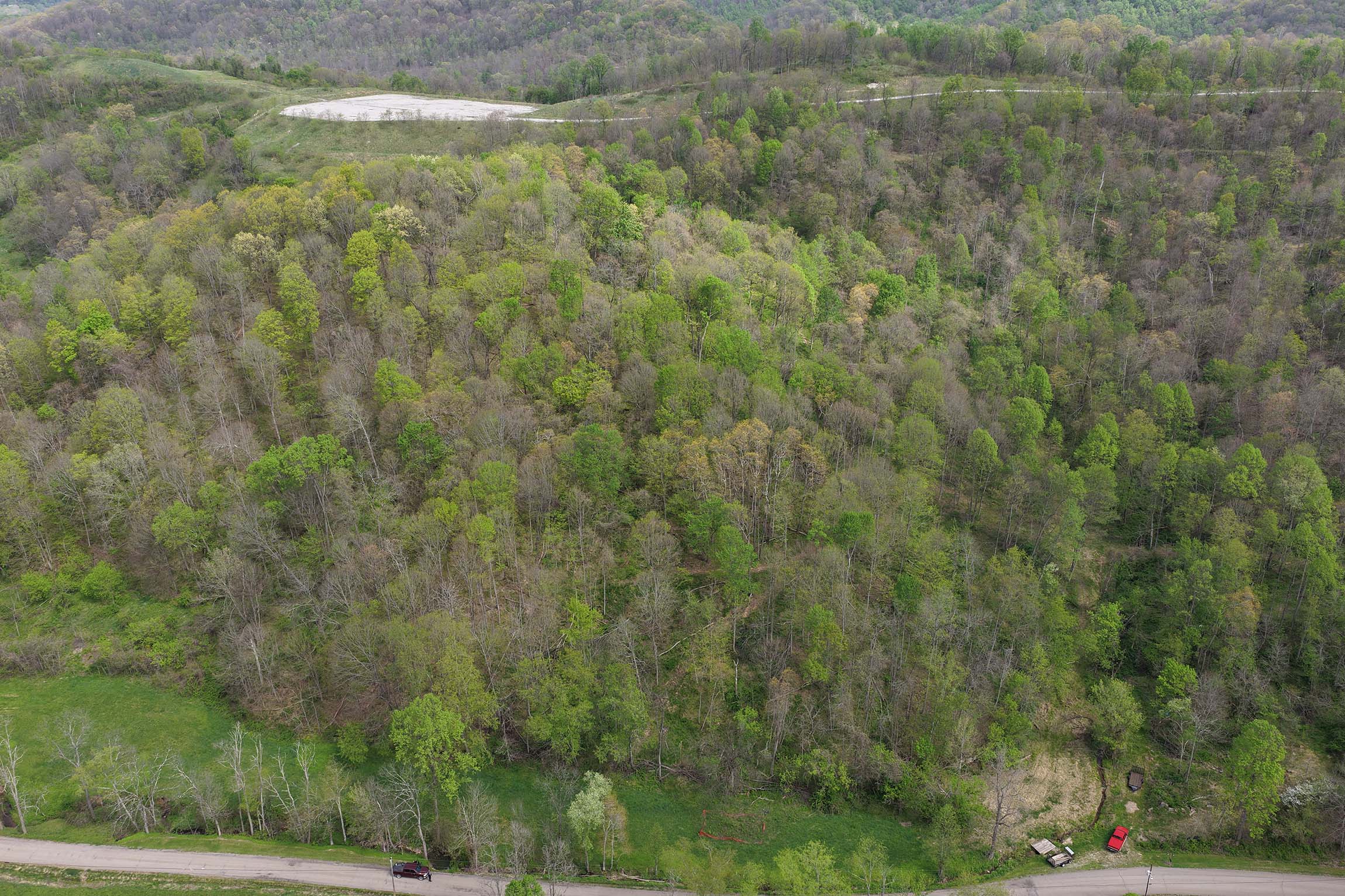
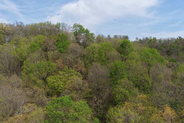
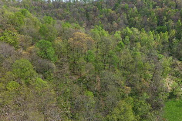
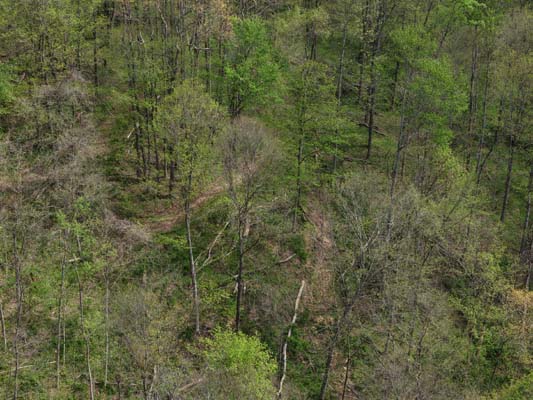
Forty acres of phenomenal hunting ground sitting in the heart of the Wayne National Forest in Monroe County, with a defined hollow, ridges pushing above twelve hundred feet, and a trail system already cut through the timber. Young hardwood stands carry the bedding and travel corridors whitetails hunt the same way every year, and this tract sits inside Ohio Wildlife District Four — the top corner of the state for big bucks and heavy turkey numbers.
Multiple ridgetops offer flat, secluded build sites with roughly one hundred eighty feet of relief from the hollow bottom, making this ground just as ready for a cabin or homestead as it is for hunting. Electric is available at the road, which cuts the cost and time to put a cabin on the ridge. The trail network is already in and rideable — side-by-side, ATV, or walking in with your gear.
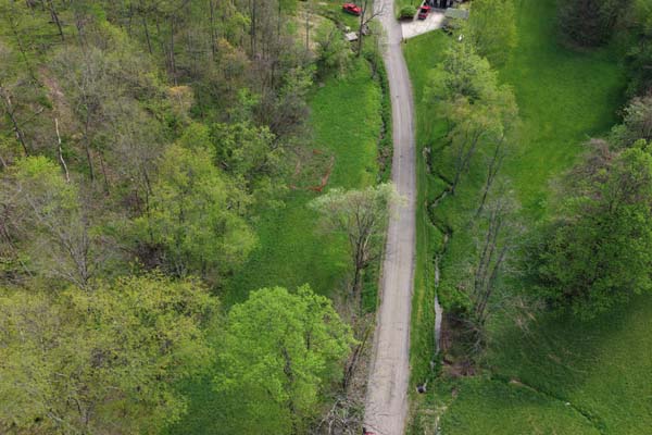
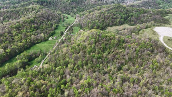
A water source runs along Joe Frobish Road at the base of the parcel, a year-round draw for game and a resource for any homestead you decide to build above it. Any public Wayne National Forest entrance is a ten-minute drive in any direction, which means tens of thousands of acres of adjoining public ground with forty private acres of your own to stage from.
The Wayne National Forest bordering this property covers roughly sixty-four thousand acres across Monroe, Noble, and Washington counties, which makes parcels along its edge a real scarcity asset. Recreational ground in Monroe County has been trading around thirteen thousand per acre, and forty-acre tracts on the forest border do not come up often.
Property Information, Access & Location
Property Facts
- 40+/- acres, one parcel
- 0 Joe Frobish Road, Sardis, OH 43946
- Monroe County, Lee Township
- Parcel: 39111-100090060000
- Annual taxes: TBD
- GPS: TBD (Lee Township confirmed)
- Mineral rights: NOT conveyed
Timber & Terrain
- Young hardwood stand — maple, oak, poplar
- Defined hollow — natural bedding
- Ridges above 1,200 ft elevation
- ~180 ft elevation relief
- Natural travel corridors for deer
- Multiple flat ridgetop sites
Access & Utilities
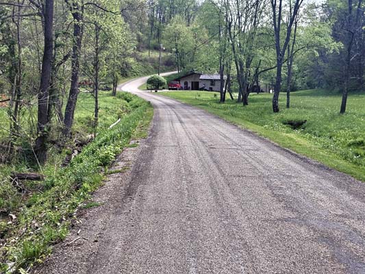
- County road frontage — Joe Frobish Rd
- Established trail system (ATV/SxS/walking)
- Electric available at the road
- Water source along road at south edge
- No gas, water, or sewer on site
Public Land & Location
- Wayne NF Marietta Unit — adjacent
- ~64,000 acres WNF (Monroe/Noble/Washington)
- WNF entrance ~10 min in any direction
- Ohio River — 6 min south at Sardis
- Hannibal Locks and Dam — ~5 mi north
- Leith Run Recreation Area — WNF/Ohio River
- ODNR Wildlife District Four
- Marietta — 40 miles south on SR-7
- Wheeling, WV — 40 miles north
- Pittsburgh — ~2 hours
Watch the Property Walkthrough
24 Property Photos — Tap to Browse
24 photos of the actual property. Click any photo to open the full gallery.
Questions About This Monroe County Wayne NF Border Tract
-
This tract sits inside ODNR Wildlife District Four — southeast Ohio's top corner for big bucks and heavy turkey numbers. Young hardwood stands carry the bedding and travel corridors that whitetails use year after year. The defined hollow and ridgelines above 1,200 feet create approximately 180 feet of elevation relief, with natural funnels and pinch points across the parcel. The trail system is already established for quiet stand access.
-
This 40-acre parcel borders the Wayne National Forest Marietta Unit directly. The WNF Marietta Unit covers roughly 64,000 acres across Monroe, Noble, and Washington counties. Any public Wayne NF entrance is approximately a ten-minute drive in any direction. The 40 private acres stage from tens of thousands of acres of adjoining public ground — a combination that makes parcels along the forest boundary a genuine scarcity asset.
-
Multiple flat, secluded ridgetop build sites are available with approximately 180 feet of relief from the hollow bottom. Electric is available at the road, cutting the cost and time to put a cabin or structure on the ridge. The trail network is already in and rideable. A water source runs along Joe Frobish Road at the south edge — a year-round resource for any homestead built above it.
-
Mineral rights are NOT conveyed with this property. This is standard for the Monroe County region. Contact Tyler Haessly at (740) 525-4582 for full details on the mineral rights situation prior to purchase.
-
Recreational ground in Monroe County has been trading around $13,000 per acre, and 40-acre tracts on the Wayne National Forest border do not come up often. The 64,000-acre WNF Marietta Unit creates a scarcity dynamic for private parcels along its edge. This property fits the hunter wanting public land adjacency, the builder wanting a ridge with a view, and the investor who understands what Wayne NF frontage does to long-term land value.
-
The Ohio River is approximately 6 minutes south at Sardis, with New Martinsville, West Virginia just across the river. Marietta is 40 miles south on State Route 7. Wheeling is 40 miles north. Pittsburgh is reachable in approximately 2 hours.
-
Showings are strictly by appointment only. A licensed agent must be present for all showings. Contact Tyler Haessly at (740) 525-4582 or Tyler@BuckeyeLandSales.com to schedule.